Everglades History & the Army Corps
The River of Grass Before the Canals
How water once moved through the Everglades: a slow, shallow sheet flowing from the Kissimmee River through Lake Okeechobee to Florida Bay.
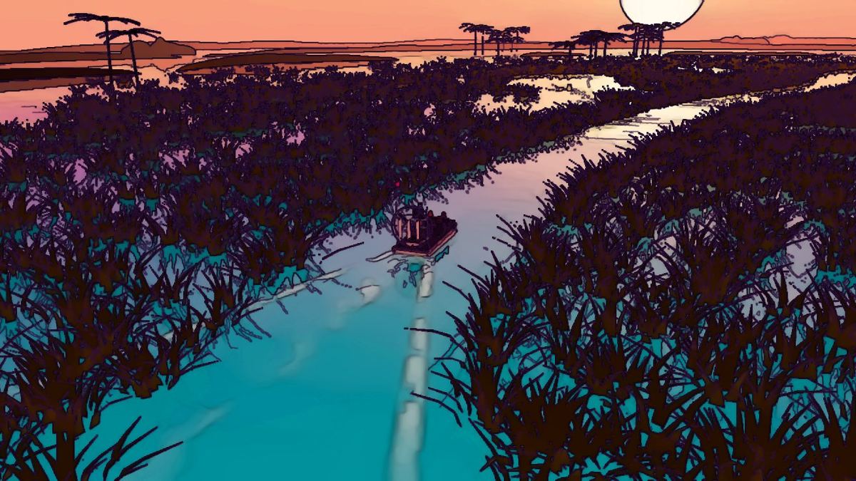
Before anyone dug a canal, the Everglades worked like a single, enormous, very slow river. Rain falling on central Florida fed the Kissimmee River, which wound south into Lake Okeechobee. In wet years the lake spilled over its low southern rim, and that water spread out across a vast, nearly flat plain of sawgrass and drifted south toward Florida Bay and the Gulf of Mexico.
A river measured in inches
The land drops only a few inches per mile, so the water never rushed. It moved as a broad, shallow sheet, often described as creeping along at roughly a hundred feet a day. In places this "sheet flow" was dozens of miles wide and only knee-deep. That is the picture behind the phrase writer Marjory Stoneman Douglas made famous: a river of grass.
Wet season, dry season
The whole system ran on a rhythm. Summer storms flooded the marsh and spread fish and invertebrates across it. In the winter dry season the water shrank back into sloughs, ponds and alligator holes, concentrating fish where wading birds could feed. Huge colonies of herons, egrets, ibis and wood storks timed their nesting to that seasonal drawdown.
Sawgrass, sloughs and tree islands
The landscape was never one uniform field. Ridges of sawgrass alternated with deeper, open-water sloughs aligned with the flow. Teardrop-shaped tree islands rose a few feet above the marsh, their shapes pointing downstream. Along the coast, the fresh water met the sea in a fringe of mangroves.
Why it matters today
Nearly every chapter of Everglades history that follows, from drainage dreams to the Army Corps of Engineers' flood-control works to today's restoration, is a story about that sheet of water: where it goes, how fast, and who gets to use it. Understanding the original system is the key to understanding why modern restoration focuses so much on sending clean water south again.
When you ride an airboat across open sawgrass today, you are crossing what remains of that river, still shallow, still slow, and still the backbone of South Florida.
How big was it?
The historic Everglades covered a huge share of the southern peninsula, stretching roughly a hundred miles from Lake Okeechobee to the mangrove coast. Today about half of that original wetland remains. The rest has been converted to farms, cities and suburbs, or cut off behind levees. Everglades National Park protects only the southern part of what was once one connected system.
The marsh and the coast were one system
Fresh water spreading across the Everglades did more than feed wildlife. It kept groundwater high along the coastal ridge where Miami now stands, pushed back against salt water underground and fed the springs and creeks that early settlers used. The Miami River itself once drained the eastern edge of the Everglades through a series of rapids, a reminder that the city and the marsh share the same water.
Seeing the old system today
Out on the sawgrass you can still read the old pattern. Look for:
- Long open sloughs running roughly north to south, the main channels of the slow flow.
- Tree islands shaped like teardrops, their rounded heads pointing upstream.
- Periphyton, the golden-brown mat of algae on submerged stems, which forms the base of the food web.
- Bird activity clustered where water is shrinking into pools during the dry months.
Your captain can point out how today's canals and levees interrupt the old flow, and why so much modern work focuses on reconnecting it.
Sources & further reading
Keep reading
 Everglades History & the Army Corps
First Peoples of the Everglades: Calusa, Tequesta, Seminole and Miccosukee
Long before drainage and highways, people lived with the Everglades for thousands of years. A short history of the region's Native nations.
Read article Everglades History & the Army Corps
The Swamp Land Act and Hamilton Disston's Four Million Acres
In 1850 Congress handed Florida its 'swamp and overflowed' lands. Three decades later a Philadelphia industrialist bought four million acres and started digging.
Read article Everglades History & the Army Corps
'Water Will Run Downhill': Governor Broward and the Drainage Era
Napoleon Bonaparte Broward made draining the Everglades a political crusade. The canals, land rush and frauds that followed shaped South Florida.
Read article